Using the latest Adobe software, we take your spatial data and field drawings and provide you with a wide range of report map options.
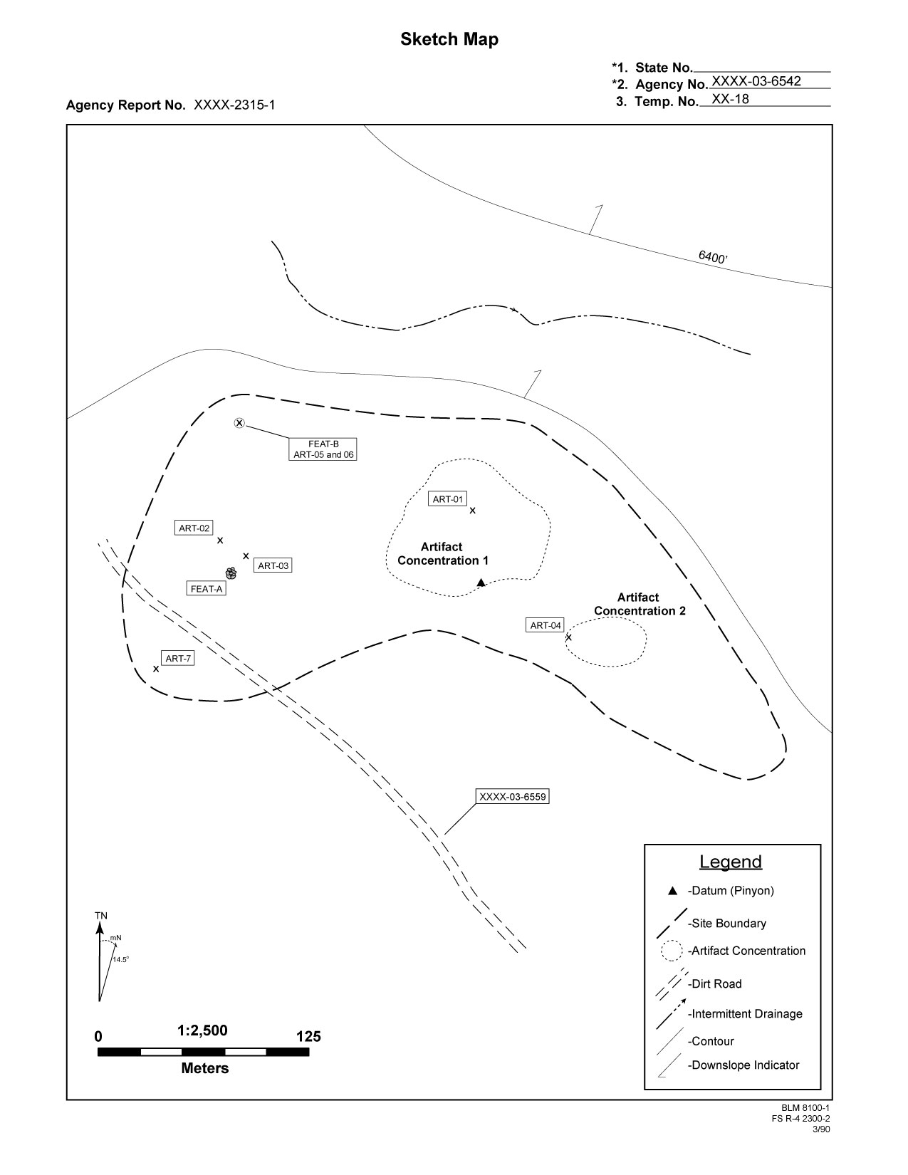
| Even in the best of circumstances, time constraints can hamper the amount of detail you are able to collect for mapping purposes. Regardless of the method by which you collected your original locational information, or the level of detail provided, we can supplement your maps with GIS data to include additional useful information. For example, the map on the right is derived solely from GPS data and has been supplmented with GIS-based contour line information. |
 |
 |
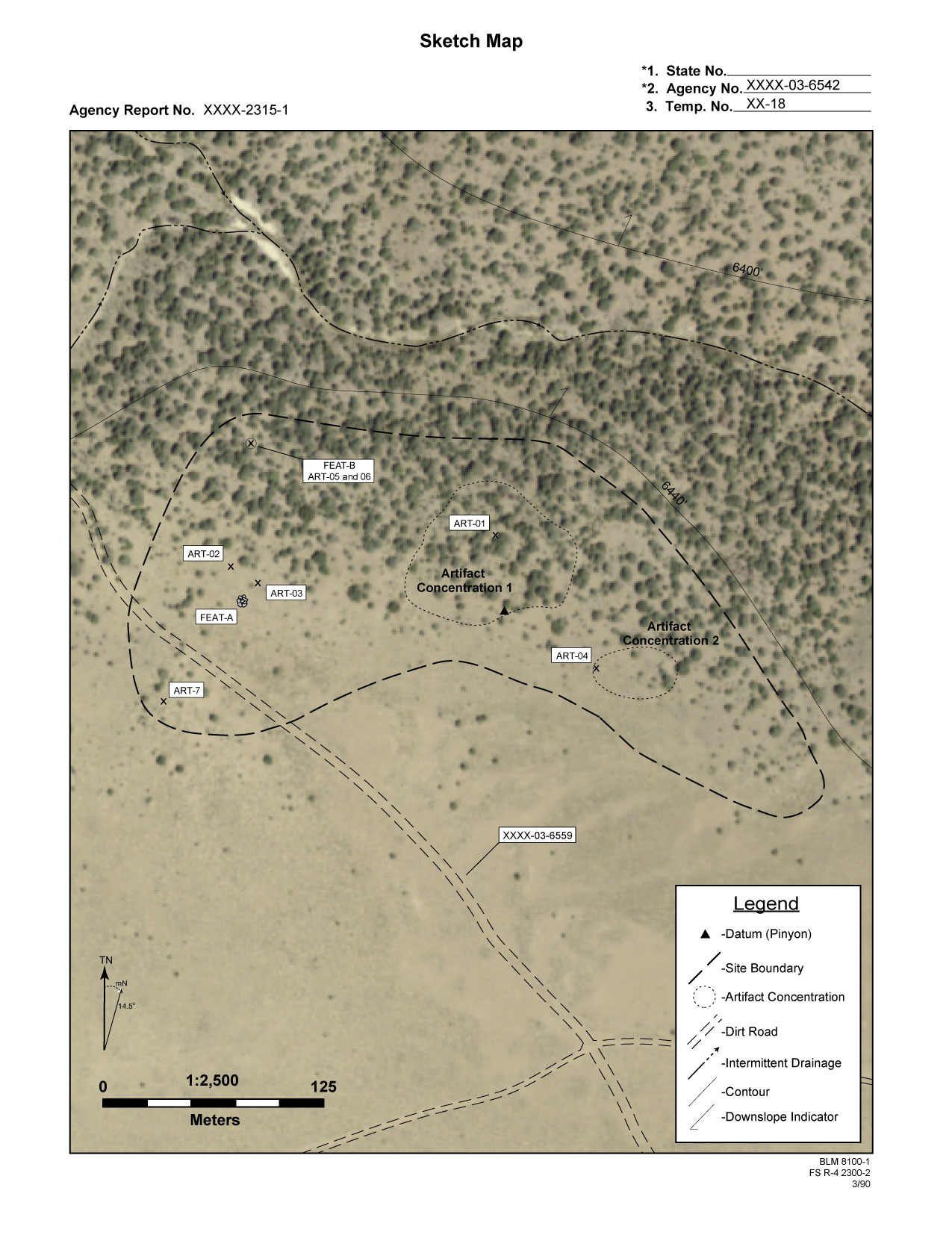
Aerial photos can help flesh out topographic features which extend beyond what was mapped in the field. Properly used aerials allow the inclusion of information unable to be collected in the field. Aerial photos allow for a great deal of flexibility in producing informative maps at various scales. This is extremely useful when two or more resources need to be joined into a single management unit, and your field data needs to be scaled accordingly. |
| Depending on the resolution of the available aerial, you might choose to have your final map include topographic information either as a semitransparent background (shown above), or in a purely graphical form (shown to the right). |
 |
|